#Product Trends
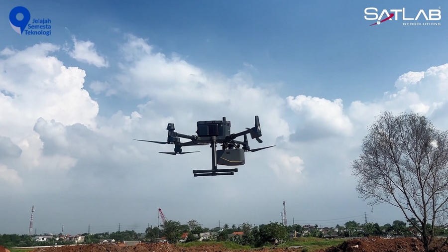
Jakarta Infrastructure Mapping: Achieved with SatLab Apus MX LiDAR Precision!
Achieved with SatLab Apus MX LiDAR Precision!
We're thrilled to showcase the incredible capabilities of the SatLab Apus-MX LiDAR! Recently, we mapped a sprawling 100-hectare area at a key Jakarta toll exit project, delivering high accuracy and highly detailed 3D spatial data.
This technology is revolutionizing urban planning and infrastructure development. Ready to bring this level of efficiency and precision to your next project?
Unmatched Precision and Efficiency
Whether you’re navigating complex terrains or surveying urban environments with significant variations in structural heights, the Apus-MX UAV LiDAR is designed to deliver unparalleled efficiency and accuracy. Optimize your workflows, increase productivity, and save valuable time with our cutting-edge technology.
I. Powerful Long-Range Laser Scanner
II. 1.55 kg Ultra-Portable Design
III. Dense Vegetation Penetration
IV. Industrial-Grade RGB Orthographic Camera
V. Advanced Inertial Measurement Unit (IMU)
#SatLabApusMX #LiDAR #Mapping #Infrastructure #Jakarta #UrbanPlanning #Surveying #Geospatial #3DMapping #PrecisionMapping #Indonesia #Technology #Innovation #ConstructionTech