#Product Trends
Full-Scene Bridge Inspection with UAV LiDAR & USV Multibeam Solution
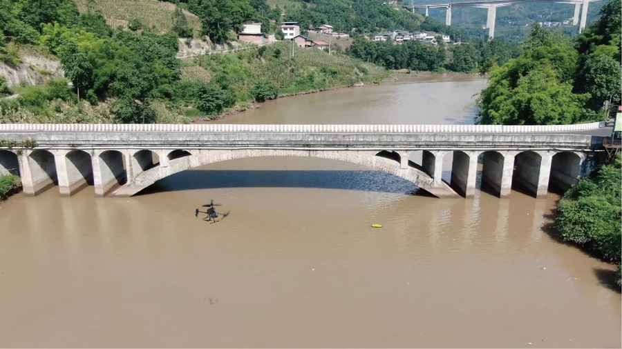
This case study demonstrates an integrated UAV–USV inspection workflow combining SatLab’s HydroBoat 1200MB with the Apus-MX LiDAR on DJI M350 RTK. The solution enables seamless data acquisition from riverbed to bridge superstructure, delivering a tru
Challenges
The project site was a major cross-river bridge with submerged pier foundations, narrow channels, shallow wetlands, and elevated structural elements. Traditional inspection methods face multiple limitations:
Accessibility limitations: Diver surveys and manned vessels are constrained by water flow, turbidity, and tight pier areas.
Safety risks: High-altitude or underwater manual inspections expose personnel to hazards.
Fragmented datasets: Above- and below-water surveys rarely integrate seamlessly, making complete 3D modeling and structural assessment difficult.
An integrated above-and-below-water solution was required to provide a complete, accurate, and safe structural assessment.、
Solution
SatLab implemented a dual-platform inspection workflow:
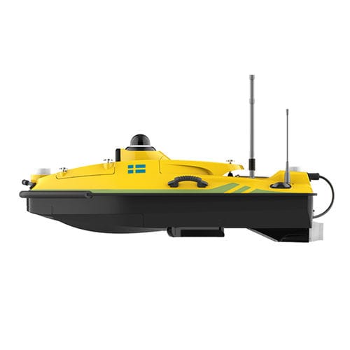
1.HydroBoat 1200MB — USV Multibeam Solution
i.Provides high-resolution bathymetric mapping and pier foundation surveys
ii.Supports rapid deployment and flexible supplemental surveys
iii.Navigates autonomously with obstacle avoidance in confined or complex areas
iv.Measures accurately without SVP, maintaining precision while simplifying workflow and improving efficiency
v.Performs reliable data acquisition even in low-visibility waters
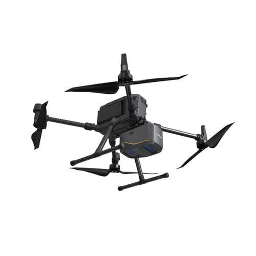
2.DJI M350 RTK + Apus-MX LiDAR — UAV LiDAR Solution
i.Rapid, high-density 3D point cloud acquisition of bridge decks, piers, soffits, and surrounding terrain
ii.Detects fine-scale defects such as cracks, spalling, or corrosion
iii.Agile flight paths enable coverage of complex structural geometries with no blind spots
3.SLHydroBeam Processing Software — Data Integration Platform
i.Integrates sonar and LiDAR datasets into a single 3D digital twin
ii.Supports automated modeling, defect detection, and analytical reporting
By synchronizing UAV and USV operations, the solution delivered seamless data fusion — bridging the gap between underwater and aerial inspection.
Operational Workflow
1. Plan Missions
Define USV routes and UAV flight paths based on design drawings and terrain; align control points and coordinate systems.
2. Acquire Data
USV runs sonar lines along pier axes; UAV performs cross-hatch LiDAR passes over deck and soffits simultaneously.
3.Verify On-Site
Real-time monitoring of coverage and overlaps; cross-checks with control points to ensure positional accuracy.
4.Process & Fuse Data
i.Multibeam: motion/tide corrections, filtering, bathymetric gridding
ii.LiDAR: strip adjustment, intensity calibration, fine registration
iii.Fusion: seamless alignment into a superstructure-to-substructure model
Deliverables
The project delivered a comprehensive 3D digital twin that seamlessly integrates sonar and LiDAR datasets. The model contains detailed thematic layers, including scour depth, pier geometry, crack distribution, and clearance profiles, providing a complete structural dataset ready for inspection and analysis.
Benefits
1.Complete Full-Scene Coverage
Unlike traditional methods that often miss underwater or high-altitude zones, the integrated sonar and LiDAR workflow ensured full coverage from riverbed to superstructure.
2.High-Resolution Precision
The workflow captured fine structural details, providing the level of accuracy needed for reliable scour and defect assessment.
3.Enhanced Efficiency & Safety
Inspection time was significantly reduced, while human exposure to hazardous underwater and high-altitude operations was minimized.
4.Digital Twin Output
Delivered a fully integrated 3D model, enabling continuous monitoring, condition assessment, and predictive maintenance planning.
Conclusion
The coordinated use of UAV LiDAR and USV multibeam sonar provides true surface-to-subsurface inspection, empowering operators with a smarter, safer, and more complete way to manage bridge infrastructure — from today’s inspections to tomorrow’s predictive maintenance. SatLab’s integrated workflow delivers reliable, comprehensive, and decision-ready data for efficient and fully-informed infrastructure management.