#Product Trends
Uninterrupted trajectory data unleashed
Delivering accurate localisation in any environment
The term mobile mapping can mean many different things to many different people. It covers a wide range of disciplines and can reference both air and land-based activities. However, it doesn’t matter whether you’re using a drone to map infrastructure, or a land-based vehicle to locate assets, one thing remains constant – the need for uninterrupted trajectory data.
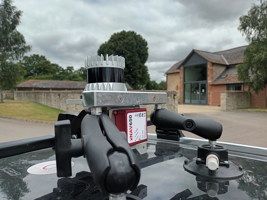
Engineers tend to use GNSS-aided inertial navigation systems (INS) to provide them with this information. An INS device combines position data from GNSS, with orientation data from an IMU, to output an estimate of its position on earth. The data can then be used for a range of georeferencing activities.
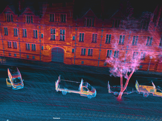
In an open-sky environment, an INS will generally output trajectory data to centimetre-level accuracy, which is comfortably precise enough for most georeferencing use cases. But, by its very nature, mobile mapping doesn’t always take place exclusively in open-sky conditions. In fact, it takes place over long baselines that incorporate multiple environmental conditions, and regular GNSS interruptions. Therefore, much of the value in mobile mapping today, comes from the ability to collect accurate, uninterrupted trajectory data across a range of different environments, with and without GNSS position updates.
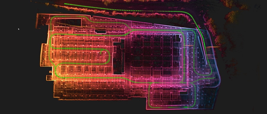
Uninterrupted trajectory data in urban canyons
For tasks such as infrastructure monitoring and asset management – two of the most widely publicised mobile mapping applications – having the ability to provide uninterrupted trajectory data in environments such as urban canyons isn’t just a ‘nice to have’ it’s essential, and can be the difference between winning and losing a project to a competitor.
To open the door to consistent, accurate data collection in built up areas, mapping fleets need to be resilient to GNSS-signal interruption or blackout, which can cause significant position drift errors and render data useless.
Learn how you can collect uninterrupted trajectory data, in any environment, on the OXTS website.