#Product Trends
From 3D Reality to Precise Coordinates: How SL9 Supports Modern Land Surveying in Indonesia
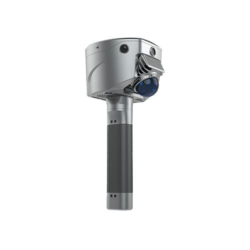
For surveyors looking for a more flexible approach to SLAM RTK surveying, 3D scanning, and geospatial data collection, the SL9 offers a way to bring field reality into a precise coordinate framework.
Turning Field Reality into Reliable Surveying Information
For professional surveyors, collecting data is only the first step. The real value comes from turning field observations into accurate, usable information that can support surveying, mapping, and engineering decisions.
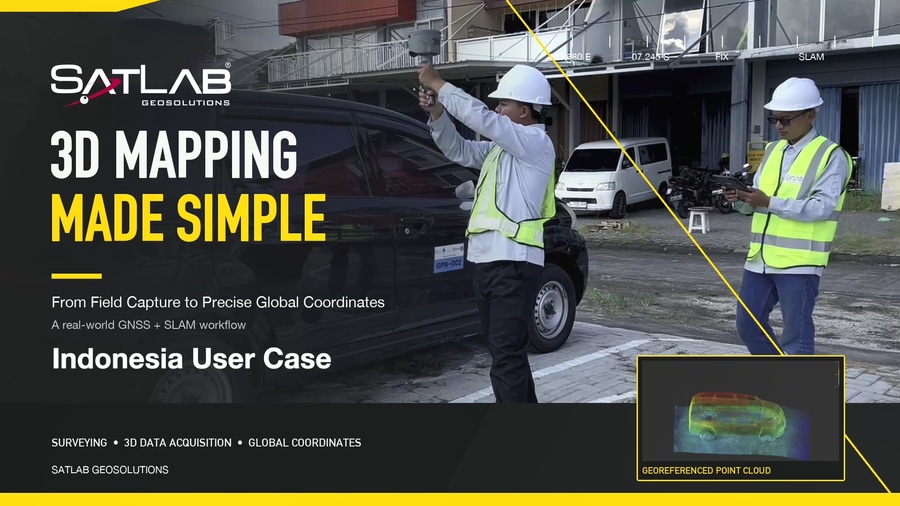
For Rifan Amiruddin, who works on surveying projects across Indonesia, this means having a field solution that allows him to capture real-world environments efficiently while connecting the collected data to a reliable coordinate framework.
Using the SatLab SL9 SLAM RTK, Rifan can capture complex environments in 3D while integrating SLAM and RTK positioning technologies into his surveying workflow.
A More Flexible Approach to 3D Field Capture
Traditional surveying workflows can require surveyors to measure individual points or repeatedly set up equipment across a site.
With the SL9, Rifan can move naturally through the survey area while continuously capturing spatial information.
As he walks through the site, the SL9 records the surrounding environment in 3D, creating a detailed representation of the physical space.
This walking-based workflow makes it possible to efficiently capture areas that may otherwise require more time-consuming point-by-point measurement.
Combining SLAM and RTK for Surveying
One of the key advantages of the SL9 is the combination of **SLAM and RTK positioning technologies.
SLAM enables the system to understand and map the surrounding environment as the surveyor moves, while RTK provides precise positioning information.
By bringing these technologies together, the SL9 provides a flexible approach to 3D scanning and land surveying, helping connect captured spatial data with a coordinate-based surveying framework.
From Reality to Precise Coordinates
For Rifan, the goal is not simply to create a 3D model.
The captured data needs to become practical surveying information that can be referenced, analyzed, and used in professional workflows.
The SL9 helps bridge the gap between the physical environment and the coordinate system:
Walk the site → Capture the reality → Process the data → Obtain precise coordinates
This workflow allows surveyors to move from field reality to structured geospatial information more efficiently.
Supporting Modern Land Surveying in Indonesia
Across Indonesia, surveyors work in a wide range of environments and project conditions. Flexibility and efficient data collection are increasingly important for modern surveying workflows.
The SatLab SL9 SLAM RTK can support applications such as:
1. Land surveying
2. 3D mapping
3. Topographic surveying
4. Construction surveying
5. GIS data collection
6. Reality capture
7. Complex site documentation
By combining mobile 3D data capture with precise positioning, the SL9 provides surveyors with a practical way to capture and coordinate real-world environments.
A Smarter Surveying Workflow
For Rifan, the value of SL9 can be summarized in a simple workflow:
Walk the site.
Capture the reality.
Get precise coordinates.
It is a straightforward approach, but it represents an important shift in modern surveying—from collecting individual measurements to efficiently capturing the surrounding environment as comprehensive 3D spatial data.
For surveyors looking for a more flexible approach to SLAM RTK surveying, 3D scanning, and geospatial data collection, the SL9 offers a way to bring field reality into a precise coordinate framework.
Discover how SatLab SL9 SLAM RTK can support modern land surveying and 3D mapping workflows.