
#Product Trends
One Walk. One Scan. One Digital Record: Capturing Bangkok's Golden Mount with the SpatiX H7 SLAM Scanner
SpatiX H7 SLAM Scanner Captures Bangkok's Golden Mount with Real-Time 3D Point Cloud
Historic landmarks deserve documentation that is as accurate as it is efficient. Traditional surveying methods often require multiple setups, extensive fieldwork, and lengthy post-processing. Today, mobile SLAM technology is changing that workflow.
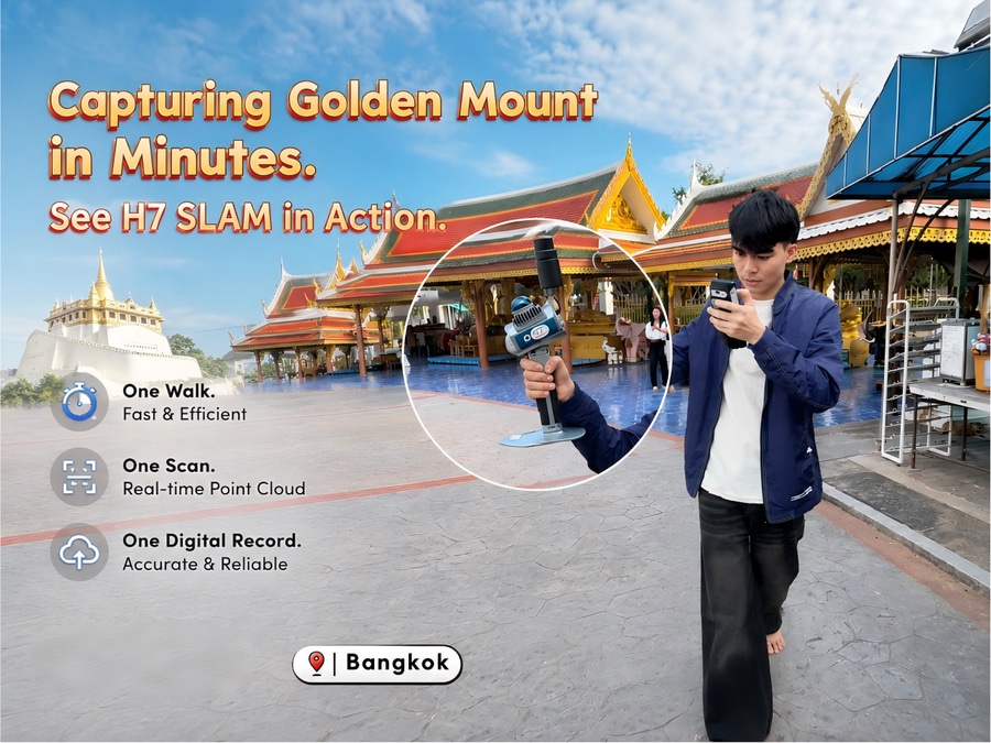
Recently, the SpatiX H7 SLAM Scanner was used to capture one of Thailand's most iconic landmarks—Bangkok's Golden Mount (Wat Saket)—demonstrating how fast, high-precision reality capture can simplify complex surveying tasks.
One Walk Is All It Takes
With the H7, surveyors can simply walk through the site while the scanner continuously captures its surroundings.
Thanks to advanced SLAM (Simultaneous Localization and Mapping) technology, the system builds a dense 3D point cloud in real time without relying on tripod setups or repeated station changes. From stairways and pathways to architectural details, the entire environment is recorded in a single workflow.
The result is a complete digital representation of the site, available immediately after the scan.
Real-Time Point Cloud, Right on Site
Unlike traditional workflows that require hours of post-processing before results can be reviewed, the H7 provides instant visualization of the collected data.
Operators can verify coverage directly in the field, ensuring that no critical areas are missed before leaving the site. This significantly reduces the need for costly return visits and improves overall project efficiency.
Whether documenting heritage buildings, surveying construction sites, or mapping urban infrastructure, immediate data validation helps teams work faster and with greater confidence.
Designed for Efficient Field Operations
The SpatiX H7 combines portability with professional-grade performance.
Key advantages include:
Fast mobile scanning with a simple walk-through workflow
High-density, high-quality 3D point cloud generation
Real-time data preview during field collection
Reduced field time and fewer repeat surveys
Suitable for indoor, outdoor, and GNSS-challenged environments
Lightweight design for easy transport and operation
From cultural heritage preservation to engineering surveys, the H7 enables professionals to capture complex environments quickly while maintaining the accuracy required for demanding applications.
Expanding Applications Across Industries
Mobile SLAM technology is becoming an essential tool for professionals working in:
Heritage preservation and digital archiving
Building and architectural documentation
Construction progress monitoring
Infrastructure inspection
Mining and tunneling
BIM and digital twin creation
Urban mapping and asset management
As projects demand faster delivery and richer spatial data, mobile reality capture is rapidly replacing traditional static workflows.
Experience the Future of 3D Reality Capture
One walk. One scan. One digital record.
The Bangkok Golden Mount project demonstrates how the SpatiX H7 SLAM Scanner transforms complex surveying into a fast and efficient process—capturing accurate spatial data in real time while keeping field operations simple.
Learn more about the SpatiX H7 SLAM Scanner and discover how it can accelerate your next surveying or mapping project.